Outdoor Access
Shetland has over 1000 miles of coastline with scenery that is on par with some of the most beautiful areas in the world along with a unique culture and heritage. Historically there is a traditional freedom of access across the isles with many places suitable to walk, cycle or horse ride, as long as you follow the Scottish Outdoor Access Code.
The Planning Service are committed to maintaining public access whist at the same time safe guarding the lively hood of crofters and farmers by assisting both users and land managers to develop and protect the fantastic outdoor environment that we have in a coordinated way as addressed in the Shetland Access Strategy.
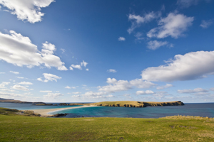
Core Path CPPD02 goes around St Ninian's Isle & Core Path CPPTWW04 runs the length of
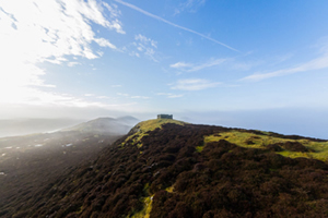
Strom Ness
Part 1 of the Land Reform Act (2003)
Part 1 of the Land reform (Scotland) Act 2003 was produced to make it easier for people to enjoy the outdoors and to be clear about what they can and cannot do. The Act provides a clear legal basis for access and responsibility is the key principle for access rights and managing land and inland water. The Act safeguards land management, privacy and conservation. It also gives new duties and powers to the Council and other public bodies.
Scottish Outdoor Access Code
Shetland's outdoors include croft land, farmland and also the open hill which all provide great opportunities for open-air recreation and education. Part 1 of the Land Reform (Scotland) Act 2003 gives everyone statutory access rights to most land and inland water. People only have these rights if they exercise them responsibly. The Scottish Outdoor Access Code explains the responsibilities of the public and of land managers in enabling all to benefit from access without disrupting each other. The act sets out where and when access rights apply while the Scottish Outdoor Access Code defines how access rights should be exercised.
The Three key principles for responsible access apply to both the public and land managers:
-
Respect the interests of other people: Be considerate, respect privacy and livelihoods, and the needs of those enjoying the outdoors
-
Care for the Environment: Look after the places you visit and enjoy. Care for wildlife and historic sites
-
Take Responsibility for your own actions: The outdoors cannot be made risk free for people exercising access rights; land managers should act with care for people's safety
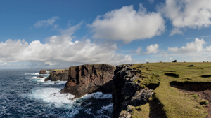
CPPN02 takes you along the Eshaness Coast - CPPLN04 takes you past Stanes of Stofast
Useful Links:
Contact:
Outdoor Access Officer
Shetland Islands Council
8 North Ness Business Park
Lerwick, Shetland
ZE1 0LZ
If you have any queries, please email the Outdoor Access Officer via outdooraccess@shetland.gov.uk or telephone 01595 744 169