An aerial survey of Shetland will take place in the coming weeks, using laser scanning equipment on a fixed-wing aircraft to produce a high-resolution digital elevation model of the isles.
While there have previously been aerial surveys of parts of Shetland, this will be the first time that a comprehensive LiDAR (‘Light Detection And Ranging’) topographic survey has been carried out for the whole of Shetland.
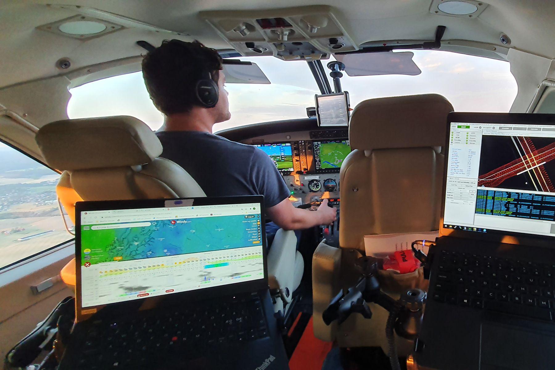
LiDAR is a remote sensing technology that uses rapid laser pulses to measure distances and to create highly accurate 3D-point clouds of the environment and aerial photography. The survey will use eye-safe precision laser scanning equipment, with the aircraft flying parallel flight lines across the isles.
The contract to produce a LiDAR survey and aerial imagery of Shetland has been awarded to Field Geospatial AS of Oslo, who are one of the largest geospatial survey providers in Northern Europe. The company operates a fleet of survey aircraft and has extensive experience of airborne surveys in coastal and island environments, including previous surveys of Orkney and the coast of Northern Ireland.
Around 90% of the project costs will be covered by Scottish Government, through two different sources of coastal adaptation funding. Once the raw aerial data is processed, the survey models will principally be used to plan and prioritise coastal adaptation work in Shetland, to help mitigate the impact of future sea level rise and coastal erosion.
The models can also be used locally for a range of other purposes, such as to inform peat condition studies and restoration projects, for landslide stability analysis, and for archaeology studies and large-scale engineering works. The data will be a resource for a range of users including crofters and the wider agricultural sector, third sector organisations, community organisations, charities and businesses.
The LiDAR survey will also provide essential information for a range of other national level work from Scottish Government, SEPA, Nature Scot and RSPB. The survey information will eventually be available to download for general use under license from the Scottish Government’s Spatial Data Portal.
As well as accurate terrain modelling, LiDAR technology is now used globally for a wide range of applications including forestry, agriculture, security, robotics, mining and by autonomous vehicles.
The dates of the survey will be confirmed soon, when there’s a suitable weather window for these flights.
Dennis Leask, Chair of the Council’s Development Committee, said: “This LiDAR survey will provide us with highly accurate terrain and coastal data for the whole of Shetland. This will really help with a range of local projects and areas of work, now and in the future, that will be of benefit to the Shetland community and our economy.”
Notes for Editors
- More details on Topographical LiDAR are available on the website of Field Geospatial AS - https://fieldgeo.com/service/topographical-lidar/
- More details on the Scottish LiDAR programme are available on the Scottish Government Blog at: https://blogs.gov.scot/digital/tag/scottish-land-lidar-programme/