
 Watch us on
  #shetlandoutdoors
 Mavis Grind Chambered Cairn
This trip we’re going on a shorter less challenging walk from Mavis Grind where the Atlantic Ocean and North Sea are only 100m apart along a wonderful shore line to the remains of an ancient chambered cairn.
The return walk is only about 2.5km or 1.5 miles, though there is a short steep hill to go up and down both ways. The ground under foot is a mix of track and grass with one narrow burn to step across, it can be a bit boggy around that.
You can download a PDF of the route to print off here or a GPX for mobile gps devices or apps here.

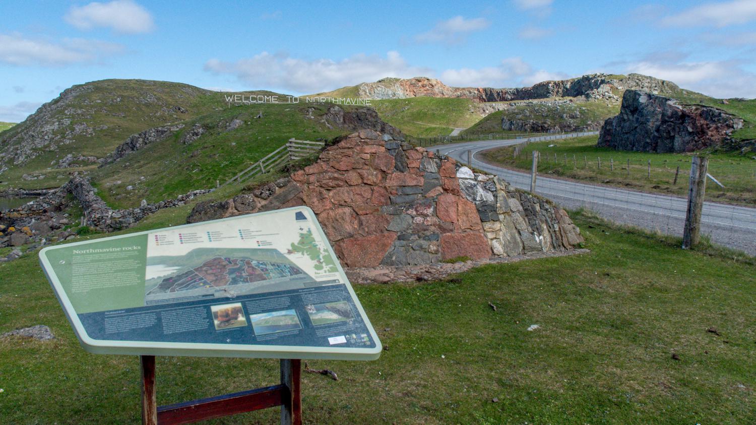
Parking at Mavis Grind, to the right is Sullom Voe and the North Sea, but we’ll go straight on through the gate towards the Northmavine sign on the hill top with the Atlantic coming in on our left. The pyramidal concrete blocks at the head of the voe are left over tank traps from WW11.

Take some time to look and the information on the panels about the local geology and Mavis Grind history before going on past the geological wall and up towards the ‘Welcome to Northmavine’ sign.
Passing by the old Foy and picnic area there is a steep climb up a tracks past quarries until you turn down a steep grassy track on your left to return to the voe side. This bypasses some rocky outcrops on the coast.
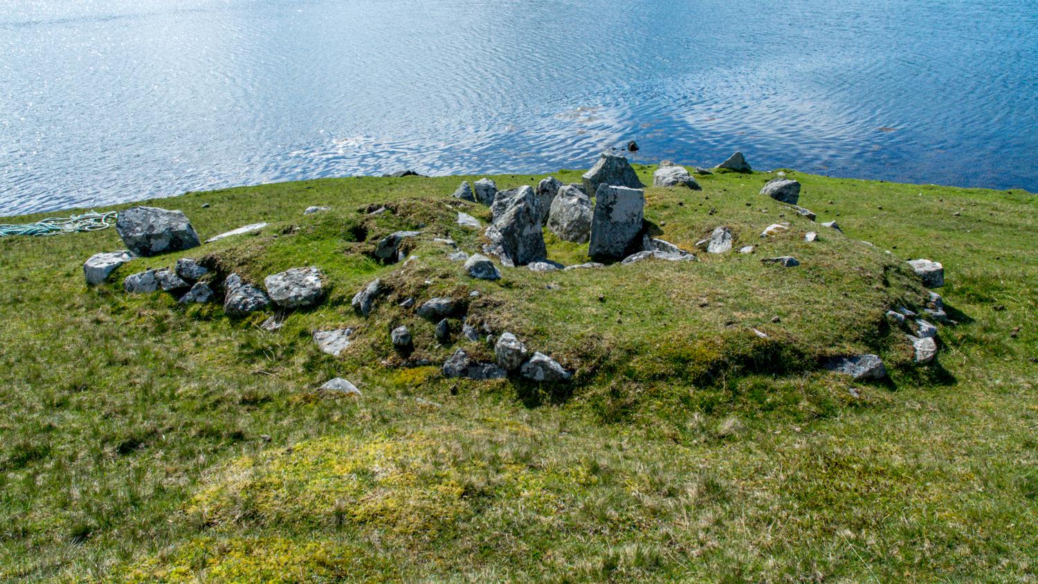
Follow around the coast and over a small burn using the stiles and gates and soon the chambered cairn will come into view opposite The Holm of Culsetter.
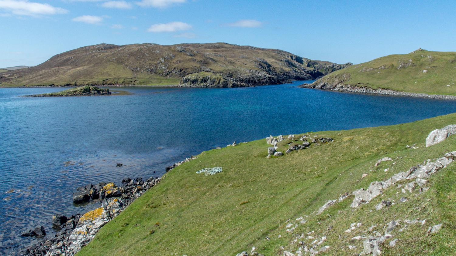
The cairn is well worth closer inspection and it’s an ideal spot to sit a while, enjoy the view and look for wildlife. Otters are not unknown around here.
This is as far as the core path goes. You can just follow the same route back, or if you’ve got the time and energy feel free to explore further around the coast as is your right under the Scottish Outdoor Access Code.
Until next time, take care and enjoy #shetlandoutdoors on Twitter and YouTube and tag us in any of your postings!
Share and Enjoy: These icons link to social bookmarking sites where readers can share and discover new web pages.